Run time: Afternoon
One of my favorite things about running in a tourist zone is passing bicyclists going uphill. This is not a knock on such people, but many of the tourists who rent bicycles are interested in a leisurely ride. Ergo, they do not feel the need to power up hills. It is fun to power up hill by foot and pass cyclists who are weighed down by their cameras and their sightseeing.
Editors note: Plenty of other cycling tourists did pass Josh going uphill as well, but he apparently did not feel the need to mention that
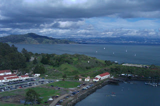
I spent a long early afternoon (two hours) waiting from a high point in the shadow of the Golden Gate Bridge for the forecast tsunami to arrive. Not knowing what a normal tide looked like, I wasn't really able to distinguish it. Some of the waves were pretty rough and spilling over the barrier onto the sidewalks, but nothing overly threatening.
tsunami?
Having stood so long staring at the bridge and the beauty across it--not to mention acting as everyone's personal photographer--I decided to run across it and explore the other side a little. I took my trusty GPS with me for your constant and unceasing enjoyment.
View 2-27-2010 in a larger map
I hope that by now you have realized that these maps are interactive. You can zoom in and explore if you'd like. I posted the original zoomed out so far so that you can take in the whole bay neighborhood as I did from afar the whole day.
Unfortunately, there doesn't seem to be a foot path from the north side of the bridge to Sausalito. What a crime. The road there is narrow and windy, so I opted not to run, at least not on this day.
At one point on the run across the bridge, there was a clearing, so I took off as fast as I could. There is something exhilarating about sprinting across the Golden Gate Bridge, probably enhanced by the fact that it was my first time setting foot there.
A small piece of me would like to run across the entire length as fast as I can. It could be a Golden Gate Bridge PR time trial of sorts.... We will see how that idea develops. There are so many other beautiful places I would like to run in this city first.
Here are so photos I took during the run, without geotags because I am bitter that HTC Footprints is not importing properly.
Always an engineer.
Oops how did that get in there?
Trail head right next to the north side of the bridge. I will check this out later.
Created by My Tracks on Android.
Total Distance: 9.08 km (5.6 mi)
Total Time: 1:05:18
Moving Time: 48:41
Average Pace: 7.19 min/km (11.6 min/mi)
Average Moving Pace: 5.36 min/km (8.6 min/mi)
Min Pace: 3.03 min/km (4.9 min/mi)
Min Elevation: 3 m (9 ft)
Max Elevation: 73 m (238 ft)
Elevation Gain: 272 m (894 ft)
Max Grade: 4 %
Min Grade: -18 %
Recorded: Sat Feb 27 14:28:05 PDT 2010


Well that was a scary post. Thank god you're ok- that tsunami looked like it could have swept you away at any minute.
ReplyDelete